
Hoover Neighbor Record Sources
A block lookup begins with geometry. The parcel map shows which lots truly adjoin the target, while the assessment roll identifies the owner and separates the site address from the tax mailing address. Deeds explain selected ownership transfers. Voter and neighborhood information uses different access rules and must not be treated as a complete household roster.
| Source | Block-Level Evidence | Access Route |
|---|---|---|
| Shelby GIS | Surrounding parcels, owner/address, legal and deed links | Free map, shapes, buffer, CSV; 1,000-result cap |
| Jefferson GIS | Adjacent boundaries, owner/address, footprints, municipality and zoning | Free map and individual parcel tax links |
| County assessor | Owner, situs, mailing address, value and exemption | Free web search or office fallback |
| County deeds | Recorded ownership transactions for chosen parcels | County index and record-room counter |
| Voter file | Approved public voter fields by requested geography | Paid order; protected addresses removed |
| Neighborhood groups | Public association contact and community identity | City list or direct group contact, not a resident roster |
These records answer different questions. The map proves adjacency. The tax roll names an owner. Neither proves who sleeps at an address, and neither supplies every person who lives on the block.
Choose Hoover Neighbor Maps
Hoover spans Jefferson and Shelby Counties. Confirm the parcel’s county and city status before searching nearby lots. A Birmingham, Vestavia Hills, Pelham, or Helena mailing label can still attach to a Hoover parcel, while a Hoover postal label alone does not establish city jurisdiction. ZIP codes are delivery areas, not parcel boundaries.
Jefferson Enterprise GIS can search address, owner, or parcel and display parcel lines, building footprints, municipality, zoning, and flood information. Its parcel layer updates nightly. Shelby GIS supports the same basic address, owner, and parcel start, then adds a documented set of selection shapes and buffers. The Property Tax Commissioner remains the human fallback when a Shelby viewer errors or a recent deed has not reached the tax roll.
Note: Select the parcel by its map boundary, then follow the linked tax detail rather than assuming the nearest street label is exact.
Map Hoover Neighbors Nearby
Shelby GIS offers the most complete documented adjacent-parcel workflow. It can use a point, line, polyline, extent, circle, polygon, or freehand shape. Its default buffer is 100 feet, and the distance and units can be changed. Results can be added or removed, flashed on the map, emailed, linked to parcel or deed detail, and exported to CSV.
- Find the target by full street address, owner, or parcel and confirm it lies in Hoover.
- Select the parcel or place a point, then draw a circle, polygon, extent, or freehand area around the immediate block.
- Apply the buffer, inspect each returned parcel, and remove lots that do not match the intended radius.
- Open parcel detail for owner, situs, mailing address, subdivision, and deed link. Keep ownership separate from residence.
- Export only the fields needed for lawful personal research. Use the Hoover by-street directory when the goal expands to a full named road.
The viewer caps a search at 1,000 results, which is ample for an immediate block but discourages careless citywide collection. Its Swipe tool can compare recent cadastral years, and the measure tool checks actual distance.
Click Hoover Jefferson Parcels
On the Jefferson side, search the target address, zoom until parcel edges and building footprints are distinct, and click adjacent lots one at a time. Follow the tax-detail link for the owner, physical property address, mailing address, parcel number, classification, value, exemption, and selected tax data. The official guide does not document a public buffer and export workflow as fully as Shelby’s, so do not invent one.
A Jefferson parcel number can also keep similar street addresses apart. The standard number strips spaces and punctuation when entered into CAPture. Preserve that number before opening deeds or comparing another tax year. Deeds remain with Probate Recording through LandmarkWeb and its Birmingham or Bessemer counter fallback.
Owner mailing and physical addresses may match, but that is only supporting evidence. A homestead exemption can support owner occupancy under Alabama law, yet it does not identify other nearby residents within the home.
Hoover Neighbor Voter Limits
Alabama VoterView is not a street or block browser. It requires a registrant’s first name, last name, date of birth, and reCAPTCHA to confirm one match. A match may show registration status, polling location, and election detail. Participation history shows elections in which a person voted, never the ballot choice.
Block-level voter work requires a lawfully ordered geographic file under Ala. Code §17-4-38. The state form permits county, city, or district selection and offers approved fields such as name, status, residence address, registration date, precinct, ward, or council area. Delivery can be mail, email, or pickup, with paper or electronic formats. The requester should order only the needed geography and fields.
Protected addresses. Qualifying victims and specified officials and spouses may have addresses withheld or reduced to a name-only public listing.
A missing voter result is not proof that no one lives at the address. A person may not be registered, may have moved, may be inactive, or may have protected data. Treat the file as one dated public roll, not a full list of Hoover neighbors.
Hoover Neighborhood Contact Directory
The City of Hoover publishes ten neighborhood organizations. They add a community layer that county parcel records cannot supply. The list offers association identity and a route to public contact, not a verified membership directory. Updates go through the City Clerk at cityclerk@hooveralabama.gov.
The named groups also reflect Hoover’s patchwork growth. Bluff Park carries an older community identity, Riverchase joined Hoover in 1980, and Inverness and Greystone entered the city’s later expansion. Those histories can explain why a neighborhood name, postal city, subdivision plat, and municipal boundary do not line up neatly. Use the association name to understand the community, then use county GIS to determine the legal parcel and its true adjacency.
| Listed Organization | Community Area |
|---|---|
| Arbor Hill HOA | Arbor Hill |
| Bluff Park Community Organization | Bluff Park |
| Deer Valley HOA | Deer Valley |
| Highland Crest HOA | Highland Crest |
| Inverness Masters HOA | Inverness |
| Lake Crest HOA | Lake Crest |
| Monte D’Oro Neighborhood Association | Monte D’Oro |
| Riverchase Residential Association | Riverchase |
| Russett Woods HOA | Russett Woods |
| The Preserve HOA | The Preserve |
Use the official Hoover neighborhood association list to find the group’s public channel. Ask about public meetings, civic news, or intentionally published resources. Congregation, watch, club, and association rosters remain private unless the organization chooses to publish them.
Note: Association contact confirms a community organization, not that a named person belongs to it or lives nearby.
Compare Hoover Neighbor Lookups
Commercial neighbor tools may blend assessor, deed, marketing, and other datasets. They can merge relatives, retain stale addresses, or present owners as current residents. Official sources are narrower, but each has a named custodian, a defined field, and a correction route. The best choice depends on the question.
| Source Type | Best Use | Main Limit |
|---|---|---|
| County GIS and assessor | Parcel adjacency, owner, situs and mailing fields | Ownership is not occupancy |
| County deed index | Recorded transfer and legal description | A party to a filing may not live there |
| Lawful voter file | Dated public registration fields by allowed geography | Not every resident; protected addresses omitted |
| Commercial compilation | Possible lead for later verification | Unknown lag, source blend, and identity merging |
Correct an assessor error through the assessor or Board of Equalization, a deed issue through Probate, and voter data through the Board of Registrars. A third-party compilation does not control the official record.
Records That Are Not Neighbors
Some public databases are searchable by name but do not define a block. Jail records, court dockets, business filings, and professional licenses answer their own narrow questions. They should not be used to label every person near an address or infer facts about a household. Match a public record to the right person with independent identifiers before drawing any conclusion.
The official Jefferson Inmate Inquiry pictured here is a custody-only search, not a block directory.
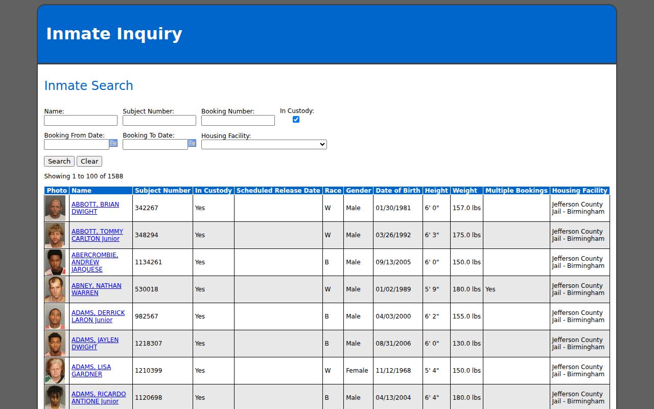
Its presence makes the distinction concrete: a custody query can report a booking record, but it cannot show who lives on a Hoover block. Court or jail status also changes, so verify the date and official detail.
Protect Hoover Neighbors’ Privacy
Public records leave major gaps by design. Renters, relatives, and other household members may not appear in land records. Utility customers, alarm responders, and library users are not public resident directories. Motor-vehicle personal data is restricted by federal law. Alabama also protects certain voter addresses and reduces private identifiers in court records.
Lawful use. Use Hoover neighbor records for civic curiosity, reconnecting, and personal safety. Never use them to watch, threaten, intimidate, stalk, or harass.
Keep the scope close to the legitimate question. Check map dates and assessment years. Confirm a surprising result with the office that owns it, and avoid publishing a protected or sensitive address. Delete working exports when they are no longer needed, and never repost a county file as if it were a current household roll. A block map can show land relationships. It cannot grant a right to intrude on the people who live there.