
Walk a Hoover Street Record
A Hoover by-address search works as a chain. Begin with one standard address. County property data supplies the parcel and assessed owner. GIS places that parcel among adjoining lots. The acquisition deed identifies the seller, buyer, recording data, and legal description. A lawfully ordered voter file or an old criss-cross directory may add dated evidence about named people at the address. Each source answers a narrower question than “who lives here.”
Write down the source date. Tax rolls, recorded deeds, directory surveys, and voter files update on different cycles. A deed may be newer than the assessment roll. A directory may reflect a canvass made months before publication. Keep owner and occupant claims in separate columns.
- Verify the parcel’s county, Hoover municipal status, and standardized address in county GIS.
- Search the physical property address in the correct assessment system and retain owner, mailing address, parcel, and legal description.
- Browse nearby parcels to distinguish repeated house numbers, separate lots, and subdivision boundaries.
- Open the acquisition deed, then search the seller as an earlier grantee when ownership history matters.
- Use lawful voter-file fields or dated reverse directories only as separate evidence of a named person at that location.
Note: The address chain is strongest when parcel, legal description, and dates agree across records maintained for different purposes.
County Comes Before Hoover Street
A Hoover address may lie in Jefferson County or Shelby County. The city’s irregular shape grew through annexation, including Riverchase in 1980 and later expansion toward Inverness and Greystone. Meanwhile, mail can use Birmingham, Vestavia Hills, Pelham, or Helena even when the physical parcel is inside Hoover. ZIP code and postal city are delivery labels, not proof of county or municipal jurisdiction.
Use county GIS to settle the question before opening a recorder or assessor portal. Jefferson Enterprise GIS can show parcel boundaries, municipality, zoning, flood information, building footprints, owner and address attributes. Shelby GIS supports address, owner, and parcel searches plus map selection. The correct map prevents a fruitless search in the wrong deed index.
Insider tip. A Birmingham postal label can still map to Hoover, so confirm the parcel boundary before trusting any street-directory result.
Jefferson Hoover Street Fields
Jefferson CAPture is the main assessment search for the Jefferson side of Hoover. The portal distinctly labels Mailing Address and Property Address. The property address, also called the situs, is the physical parcel location. The mailing address is where the tax notice goes. It may point to the same place, another city, or an entity’s correspondence address. Never turn that second field into an occupancy claim.
Official instructions call for owner searches in last-name-then-first-name order. Address searches begin with the street number and street name. Parcel searches omit spaces and periods. A result can expose owner, parcel, physical and mailing addresses, classification, values, exemptions, and a tax-detail link. The roll does not publish a complete household.
| Search field | Value type | Required | Hoover street use |
|---|---|---|---|
| Name | Owner text | No | Find parcels tied to a known assessed owner |
| Parcel # | County identifier | No | Open one exact parcel without address ambiguity |
| Mailing Address | Correspondence address | No | Compare where the tax notice is sent |
| Property Address | Physical situs | No | Start a by-address search |
| Tax Year | Year selection | No | Anchor the owner result to the displayed roll |
Jefferson’s standardized parcel example encodes township, section, quarter, block, and parcel components. Save the displayed identifier exactly. It gives county staff a better reference than a loosely spelled street.
Shelby Hoover Streets by Shape
Shelby GIS provides the strongest documented street-browse tools for Hoover’s Shelby side. Basic autocomplete accepts street address, owner, or parcel. Enhanced Search can select parcels by shape or value, choose the Parcel Owner or Subdivision layer, limit the map extent, and choose from recent cadastral tax-year layers. A cadastral layer is the mapped parcel fabric for a given roll year.
Shape choices include point, line, polyline, extent, circle, polygon, and freehand. The buffer starts at 100 feet but can be changed with its unit. Results can be added or removed, zoomed, panned, flashed, emailed, followed to parcel detail or a deed link, and exported as CSV. The documented search cap is 1,000 results. That is ample for an immediate block but a warning against treating an export as every Hoover resident.
A practical Hoover street-search method draws a narrow line or polygon along the named road, reviews the selected parcel edges, then removes side-street lots that do not fit the question. Record the search shape, date, layer, and buffer so another researcher can repeat it.
Hoover Address Records Compared
Address-keyed records overlap, but they do not duplicate one another. The parcel roll anchors the physical site and assessed owner. GIS explains the map setting. Deeds prove recorded transfers. Permits can date physical work. Voter data has a strict access route. Reverse directories provide a historical subscriber or householder clue.
| Address source | Record keeper | Street evidence | Access channel |
|---|---|---|---|
| Assessment roll | Jefferson Assessor or Shelby PTC | Owner, situs, mailing, parcel, roll data | Web search plus office fallback |
| Parcel map | County GIS | Boundaries, nearby parcels, municipality, deed links | Free viewer |
| Recorded deed | County Probate Recording | Parties, transfer, instrument, legal description | ROAM, LandmarkWeb, or record room |
| Voter file | Alabama elections officials | Selected lawful fields by ordered geography | Paid request with protected addresses removed |
| Permit or code file | Hoover Clerk and city departments | Work, applicant, contractor, dates, disposition where kept | Address-specific request |
| Reverse directory | BPL or ADAH collection | Dated subscriber or householder at street number | Library or archives |
The parcel number links the assessor to tax detail and map features. The legal description links the parcel to a deed even when a street label changes. The address links permits and reverse-directory entries, but both require dates to mean anything.
Hoover Parcels Become Deed Chains
For Shelby County, ROAM searches Instrument Number, recording dates, last or company name, first name, document type, book and page, map references, lot, block, section, township, range, and other legal fields. Match options include Starts With, Contains, Exact, and Phonetic. Result modes separate party, legal, and document information. Exports and available images make it useful for several parcels along one street.
Some older Shelby mortgage cancellations exist only in record-room books at 112 N Main Street in Columbiana. That fact breaks the myth that the advertised 1819-present deed range means every item is online. Call Recording at 205-670-5220 to confirm the book, current copy process, and certified-copy method before travel.
Jefferson LandmarkWeb offers Name, Document, Book/Page, Consideration, Record Date Range, Instrument Number, Legal, and Quick Search modes. The site describes subscriber access and select images; exact web coverage is not published. When it stops, use the correct Birmingham or Bessemer recording counter. Search the acquisition deed’s seller as an earlier grantee to walk the chain back.
Hoover Street Terms Decoded
A few land-record terms make the address trail much easier to read. They also keep a mailing label from being confused with the parcel itself.
- Parcel
- A mapped unit of land with a county identifier used by assessment and GIS systems.
- Situs address
- The physical property address, distinct from the owner’s correspondence address.
- Plat
- A recorded map that lays out lots, blocks, streets, and other subdivision features.
- Legal description
- The lot-block-subdivision or section-township-range language that identifies land in a deed.
- Criss-cross directory
- A dated directory arranged by street and number, often pointing to one listed subscriber or householder.
If an address search fails, shift from the street text to parcel number, plat, lot, block, subdivision, or a deed’s book and page. Those record keys are more stable than a postal label.
Hoover Permits Need Addresses
Hoover Building Inspections handles building, plumbing, gas, electrical, mechanical, demolition, and sign permits. Applications may be downloaded, but the city does not publish a permit-history search. Historical work must be requested by exact address and date range through the City Clerk. A maintained permit can date construction or alteration and may name an applicant or contractor. It does not prove who occupied the property.
Code Enforcement also lacks an online case database. A focused request can ask for complaint or case number, inspection findings, date range, and disposition. Private complainant or contact details may be withheld. City staff will not create a new address report that the city does not keep in ordinary business.
For the court side of a municipal address record, the Jefferson County Circuit Clerk explains its civil, criminal, domestic, child-support, traffic, juvenile, and warrant divisions.
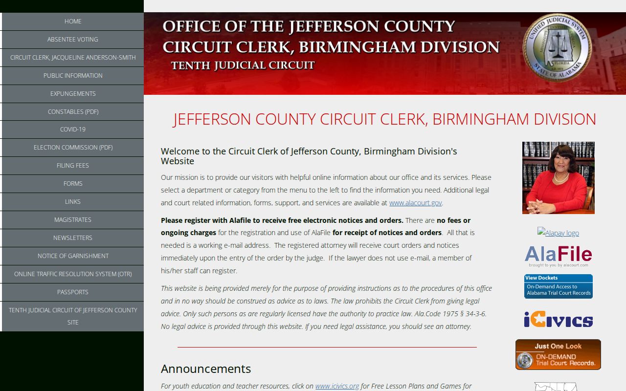
The captured clerk page is a jurisdiction fallback, not an address browser; use it only when a known case or court-held file connects to the street research.
VoterView Is No Street Directory
Alabama VoterView requires first name, last name, date of birth, and reCAPTCHA. It confirms one known registrant and polling details. It cannot browse all names on a Hoover street. A blank result can reflect an input mismatch, move, inactive status, or legal protection. It should not be read as proof that a person never lived at the address.
Street-level voter research requires a lawfully ordered geographic file under Ala. Code §17-4-38. The form supports county, city, or district scope, selected fields, active or inactive status, and several delivery formats. Protected addresses are removed. Keep the quote and delivery record, request only what is needed, and do not imply that election participation reveals a ballot choice. Alabama does not register voters by party.
Older Hoover Streets Use Other Names
Hoover incorporated in 1967. Earlier street and household research often sits under Birmingham, Bluff Park, Rocky Ridge, Green Valley, Patton Chapel, Acton, or another community heading. Riverchase joined Hoover in 1980. Later annexations shifted municipal labels again. An address can remain physically still while its catalog, postal, or city label changes.
Birmingham Public Library’s directory run begins in 1883, with separate suburban directories beginning in 1965. Reverse sections reorganize entries by street and house number. Check the alphabetical section, the reverse section, the volume key, and adjacent years. The library’s old-and-new street-name lists can resolve a label change. The historical shelves are treated in depth on the Hoover city directories page.
Note: No official citywide street-number formula or wholesale Hoover renumbering year was found, so do not invent one when an address disappears.
Hoover Street Owner Is Not Occupant
Assessment and deed records identify ownership interests. They do not name every person who sleeps, receives mail, or spends time at a property. A homestead exemption can support owner occupancy under Alabama law, but it still cannot identify the rest of a household. Reverse directories may name one subscriber. Voter files omit people who are not registered and lawfully hide protected addresses.
The mismatch can work both ways. An owner’s mailing address may be far from the physical parcel. A named permit applicant may be a contractor. A business filing may use a registered office. A deed party may have sold the land without living there. Label each person’s role rather than flattening the record into “resident.”
Hoover Street Directory Boundaries
A lawful Hoover street directory cannot expose a complete household roster. Driver-record address data is restricted by the federal Driver’s Privacy Protection Act. Library-use records, emergency alarm contacts, protected voter addresses, juvenile records, and sealed court files remain outside the public address trail. Utility or private association data is not transformed into a public roll just because it would help identify an occupant.
Commercial neighbor tools may blend assessment, deed, and marketing data, then imply relationships that the sources do not prove. Check a claim against the primary record and its date. For a whole named street, retain only the fields needed for the research purpose. For one person, shift to the dedicated resident workflow instead of expanding the search to unrelated households.
Lawful use. Hoover address records support genealogy, property research, and civic review; Alabama law does not permit stalking, threats, harassment, or harm.